Stage three consultation: Boundary options for town and parish councils (22 June to 31 July 2026)
This consultation is now closed. Thank you for sharing your views. We are reviewing all responses and will publish a summary of the findings on this page in due course.
The third stage of consultation for our Community Governance Review ran from 22 June to 31 July 2026 (closing at 5pm). Stage three covers the possible options for the boundaries for the town council and also the proposed boundary changes for the other five existing parishes and the possible creation of new parished areas.
We have explained the key terms related to this consultation to provide general information about what town and parish councils do. You can also read background information about the Community Governance Review which includes information about the stage one and stage two consultations.
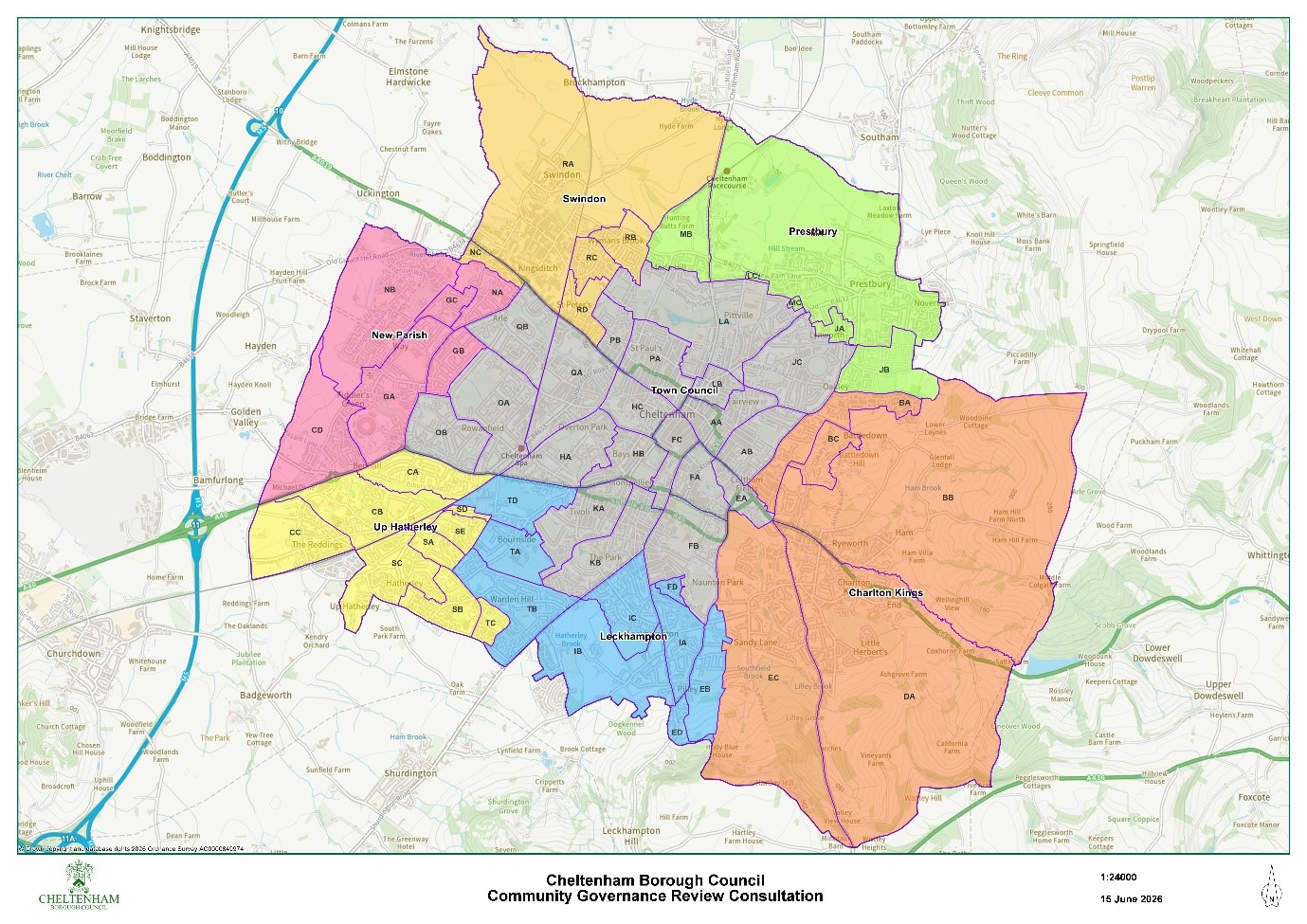
We asked for your views on the proposals as set out in Map 2 below.
For administrative reasons any new parish/town council boundaries must follow the existing polling district boundaries which are indicated on Map 2 below.
Map 1 - Existing parish boundaries
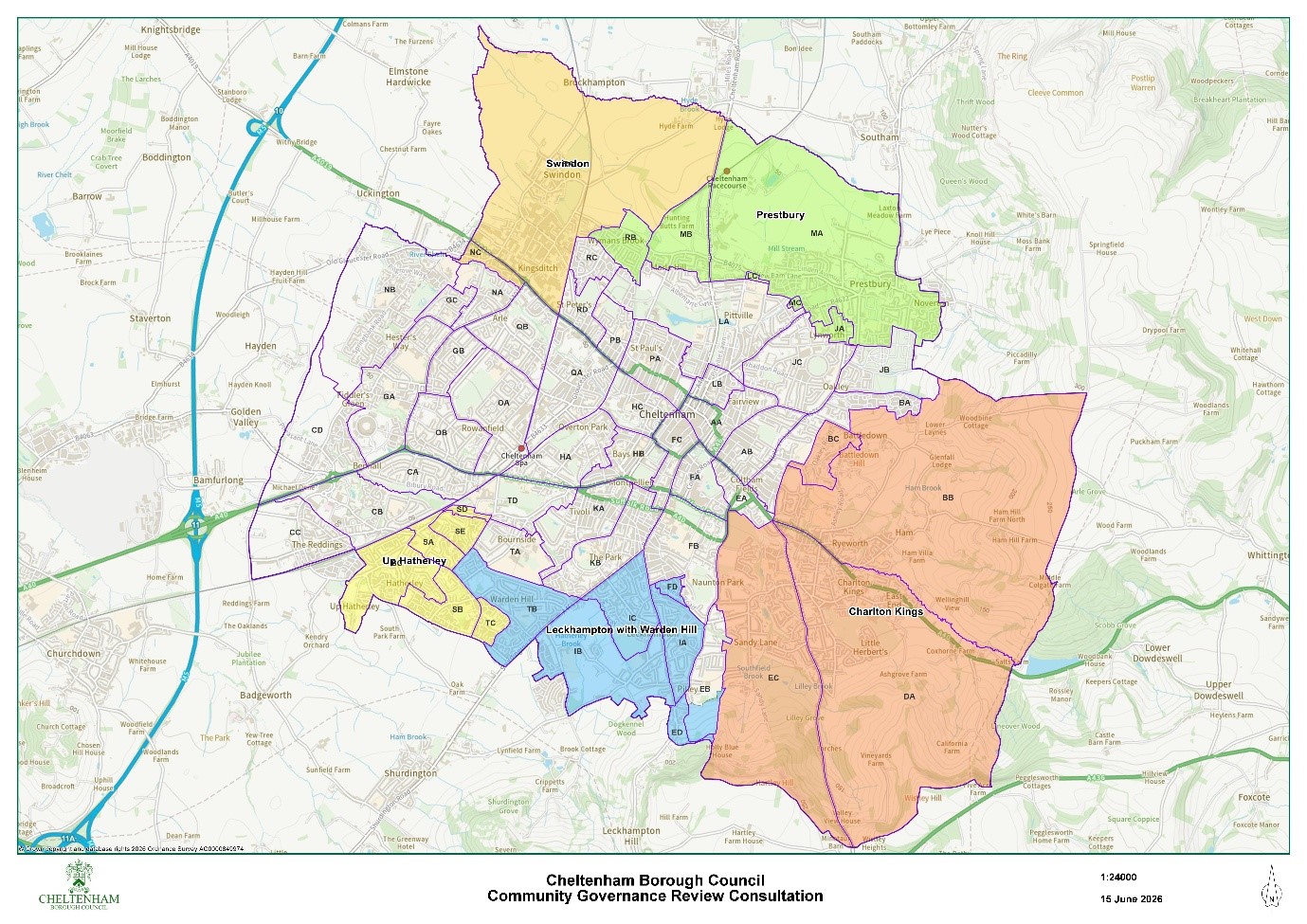
You can also view existing parishes using our online map at cheltenham.gov.uk/community-map and clicking ‘parishes’
Map 2 - Proposed new parish and town council boundaries
Map 2 has been drawn up having regard to the consultation feedback at Stage 1.
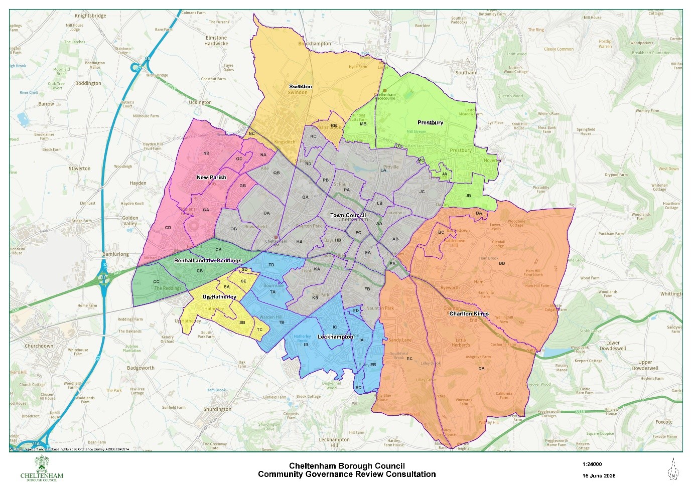
Map 3 - Alternative boundaries
Map 3 has removed polling districts RC and RD from Swindon Village Parish and included them in the proposed new town council. It also shows polling districts CA, CB and CC as a separate parish rather than being included within the Up Hatherley Parish Council boundary.
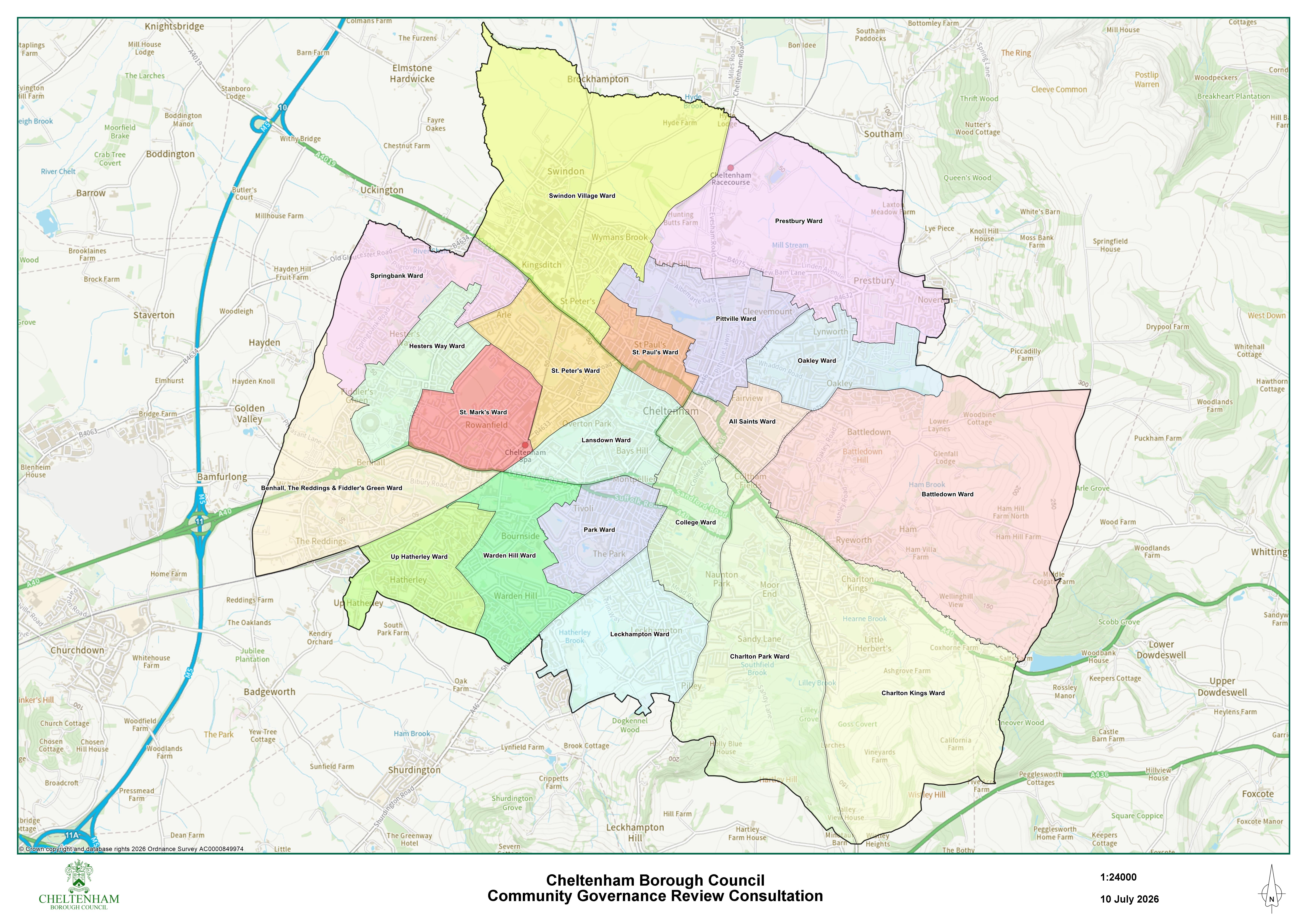
Ward boundary map
This map shows the borough wards to provide a comparison of how the proposed parish boundaries relate to the current borough ward boundaries.
Contact us
For any questions about this consultation, please email [email protected]